Kode Pos 7941 - Meppel, Drenthe
| Kota Utama | Meppel |
| Luas Kode Pos 7941 | 1.383 km² |
| Populasi | 4,638 |
| Populasi Pria | 2,259 (48.7%) |
| Populasi Wanita | 2,379 (51.3%) |
| Perubahan populasi dari 1975 hingga 2015 | -15.1% |
| Perubahan populasi dari 2000 hingga 2015 | -1.1% |
| Usia Rata-rata | 40.8 tahun |
| Usia Rata-rata Pria | 40.2 tahun |
| Usia Rata-rata Wanita | 41.3 tahun |
| Kode Area | 522 |
| Ekstensi Kode Pos | 7941 AA, 7941 AB, 7941 AC, 7941 AD, 7941 AE, 7941 AG, 7941 AH, 7941 AJ, 7941 AK, 7941 AL More |
| Timezone | Central European Summer Time |
| Koordinat | 52.69668628396949° / 6.1905568517059955° |
| Kode Pos Terkait | 7928, 7929, 7931, 7932, 7942, 7943, 7944, 7946, 7948, 7949 |
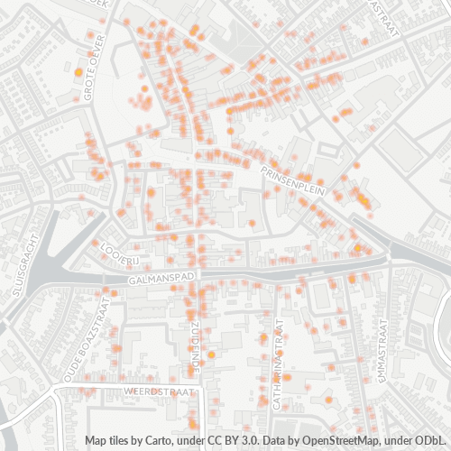
Peta Kode Pos 7941 - Meppel, Drenthe
Peta Interaktif
Populasi Kode Pos 7941 - Meppel, Drenthe
Tahun 1975 hingga 2020
| Data | 1975 | 1990 | 2000 | 2015 | 2020 |
|---|---|---|---|---|---|
| Populasi | 5.460 | 5.457 | 4.691 | 4.638 | 4.659 |
| Kepadatan penduduk | 3.947,6 / km² | 3.945,4 / km² | 3.391,6 / km² | 3.353,3 / km² | 3.368,4 / km² |
Perubahan populasi Kode Pos 7941 - Meppel, Drenthe dari 2000 hingga 2015
Penurunan sebesar 1.1% dari tahun 2000 hingga 2015
| Lokasi | Perubahan sejak 1975 | Perubahan sejak 1990 | Perubahan sejak 2000 |
|---|---|---|---|
| Kode Pos 7941 - Meppel, Drenthe | -15.1% | -15% | -1.1% |
| Meppel | +35.5% | +20.9% | +10.8% |
| Drenthe | +22.4% | +11.9% | +5.4% |
| Belanda | +24.3% | +13.4% | +6.5% |
Usia Median Kode Pos 7941 - Meppel, Drenthe
Usia Median: 40.8 tahun
| Lokasi | Usia Rata-rata | Usia Median (Wanita) | Usia rata-rata (Pria) |
|---|---|---|---|
| Kode Pos 7941 - Meppel, Drenthe | 40.8 yrs | 41.3 yrs | 40.2 yrs |
| Meppel | 40.8 yrs | 41.3 yrs | 40.2 yrs |
| Drenthe | 43.8 yrs | 44.7 yrs | 42.8 yrs |
| Belanda | 41 yrs | 41.7 yrs | 40.2 yrs |
Kepadatan Penduduk Kode Pos 7941
Kepadatan Penduduk: 3.353 / km²
| Lokasi | Populasi | Area | Kepadatan |
|---|---|---|---|
| Kode Pos 7941 | 4.638 | 1,383 km² | 3.353 / km² |
| Meppel | 28.383 | 22,4 km² | 1.268 / km² |
| Drenthe | 506.169 | 2.678,3 km² | 189 / km² |
| Belanda | 16,9 million | 41.398,3 km² | 409 / km² |
Populasi Historis dan Proyeksi Kode Pos 7941 - Meppel, Drenthe
Perkiraan Populasi dari 1500 hingga 2100
- JRC (European Commission's Joint Research Centre) bekerja pada GHS built-up grid
- CIESIN (Center for International Earth Science Information Network)
- [Link] Klein Goldewijk, K., Beusen, A., Doelman, J., and Stehfest, E.: Anthropogenic land use estimates for the Holocene – HYDE 3.2, Earth Syst. Sci. Data, 9, 927–953, https://doi.org/10.5194/essd-9-927-2017, 2017.
Kode Area
Persentase Kode Area yang digunakan oleh bisnis dalam Kode Pos 7941 - Meppel, Drenthe
Industri
Distribusi Bisnis berdasarkan Industri di Kode Pos 7941 - Meppel, Drenthe
| Deskripsi Industri | Jumlah Perusahaan | Rata-rata Usia Bisnis |
|---|---|---|
| Akuntan | 29 | — |
| Belanja | 83 | — |
| Kafetaria | 32 | — |
| Kesehatan dan medis | 30 | — |
| Konstruksi bangunan | 39 | — |
| Manajemen korporat | 75 | 47.5 years |
| Pakaian wanita | 28 | — |
| Real Estate | 28 | — |
| Restoran | 84 | — |
| Salon kecantikan | 39 | — |
| Toko elektronik | 29 | — |
| Toko pakaian | 64 | — |
Distribusi bisnis berdasarkan harga untuk Kode Pos 7941 - Meppel, Drenthe
Indeks Pembangunan Manusia (IPM)
Indeks komposit statistik dari harapan hidup, pendidikan, dan pendapatan per kapita.
Emisi CO2 Kode Pos 7941
Emisi Karbon Dioksida (CO2) Per Kapita dalam Ton Per Tahun
| Lokasi | Emisi CO2 | Emisi CO2 Per Kapita | Intensitas Emisi CO2 |
|---|---|---|---|
| Kode Pos 7941 | 52,076 tn | 11.23 tn | 37,650.7 tons/km² |
| Meppel | 319,542 tn | 11.26 tn | 14,277.6 tons/km² |
| Drenthe | 5,761,872 tn | 11.38 tn | 2,151.3 tons/km² |
| Belanda | 167,743,568 tn | 9.91 tn | 4,051.9 tons/km² |
| Emisi CO2 tahun 2013 (ton/tahun) | 52,076 tn |
| Emisi CO2 tahun 2013 (ton/tahun) per kapita | 11.23 tn |
| Intensitas emisi CO2 tahun 2013 (ton/km²/tahun) | 37,650.7 tons/km² |
Risiko Bencana Alam
Risiko relatif dari 10
| Bahaya | Tingkat Risiko |
|---|---|
| Banjir | Sedang (4) |
Gempa Bumi Terdekat Terdekat
Magnitude 3.0 dan lebih tinggi
| Tanggal▼ | Waktu↕ | Magnitude↕ | Distance↕ | Kedalaman↕ | Lokasi↕ | Link |
|---|---|---|---|---|---|---|
| 5/21/19 | 8:48 PM | 3.2 | 81.9 km | 10,000 m | 8km NNE of Winsum, Netherlands | usgs.gov |
| 2/7/13 | 3:19 PM | 3.4 | 84.5 km | 10,000 m | 11km NNE of Winsum, Netherlands | usgs.gov |
| 8/16/12 | 1:30 PM | 3.4 | 81.1 km | 3,000 m | The Netherlands | usgs.gov |
| 10/29/08 | 10:54 PM | 3.3 | 80.7 km | 3,000 m | The Netherlands | usgs.gov |
| 8/7/06 | 10:03 PM | 3.8 | 77.7 km | 10,000 m | The Netherlands | usgs.gov |
| 11/9/03 | 4:22 PM | 3.1 | 76.7 km | 10,000 m | The Netherlands | usgs.gov |
Kota Utama
Meppel, adalah sebuah gemeente Belanda yang terletak di provinsi Drenthe. Pada tahun 2006 daerah ini memiliki penduduk sebesar 30.544 jiwa.
Laman Wikipedia Meppel
Tentang Data Kami
Data di halaman ini diperkirakan menggunakan sejumlah alat dan sumber daya yang tersedia untuk umum. Data ini disediakan tanpa jaminan dan mungkin mengandung ketidakakuratan. Gunakan dengan risiko Anda sendiri.