Kode Pos 2011 - Potts Point, New South Wales
| Kota Utama | Potts Point |
| Luas Kode Pos 2011 | 2.38 km² |
| Populasi | 18,769 |
| Populasi Pria | 10,167 (54.2%) |
| Populasi Wanita | 8,602 (45.8%) |
| Perubahan populasi dari 1975 hingga 2015 | +72.6% |
| Perubahan populasi dari 2000 hingga 2015 | +25.5% |
| Usia Rata-rata | 37.4 tahun |
| Usia Rata-rata Pria | 37.9 tahun |
| Usia Rata-rata Wanita | 36.9 tahun |
| Sekitarnya | Darlinghurst, Eastern Suburbs, Elizabeth Bay, King's Cross, Potts Point, Woolloomooloo |
| Timezone | Australian Eastern Standard Time |
| Koordinat | -33.86725656642501° / 151.22623860615136° |
| Kode Pos Terkait | 2000, 2001, 2010, 2012, 2013, 2015, 2016, 2017, 2018, 2019 |
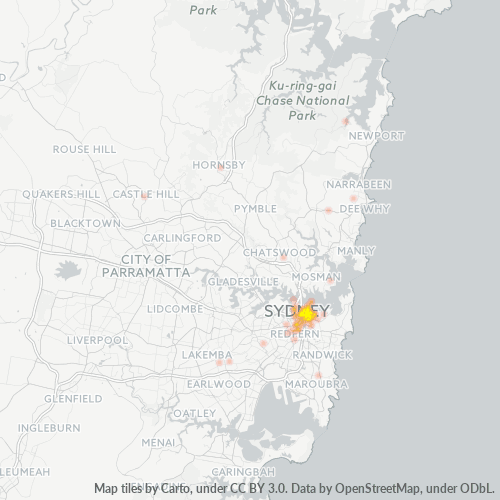
Peta Kode Pos 2011 - Potts Point, New South Wales
Peta Interaktif
Populasi Kode Pos 2011 - Potts Point, New South Wales
Tahun 1975 hingga 2020
| Data | 1975 | 1990 | 2000 | 2015 | 2020 |
|---|---|---|---|---|---|
| Populasi | 10.873 | 13.390 | 14.958 | 18.769 | 20.084 |
| Kepadatan penduduk | 4.569,3 / km² | 5.627,1 / km² | 6.286 / km² | 7.887,6 / km² | 8.440,2 / km² |
Perubahan populasi Kode Pos 2011 - Potts Point, New South Wales dari 2000 hingga 2015
Peningkatan sebesar 25.5% dari tahun 2000 hingga 2015
| Lokasi | Perubahan sejak 1975 | Perubahan sejak 1990 | Perubahan sejak 2000 |
|---|---|---|---|
| Kode Pos 2011 - Potts Point, New South Wales | +72.6% | +40.2% | +25.5% |
| Potts Point | +68.7% | +39.5% | +24.6% |
| New South Wales | +72.6% | +40.2% | +25.4% |
| Australia | +72.6% | +40.3% | +25.5% |
Usia Median Kode Pos 2011 - Potts Point, New South Wales
Usia Median: 37.4 tahun
| Lokasi | Usia Rata-rata | Usia Median (Wanita) | Usia rata-rata (Pria) |
|---|---|---|---|
| Kode Pos 2011 - Potts Point, New South Wales | 37.4 yrs | 36.9 yrs | 37.9 yrs |
| Potts Point | 36.4 yrs | 35.4 yrs | 37.2 yrs |
| New South Wales | 38.3 yrs | 39.2 yrs | 37.4 yrs |
| Australia | 37.7 yrs | 38.6 yrs | 36.8 yrs |
Kepadatan Penduduk Kode Pos 2011
Kepadatan Penduduk: 7.888 / km²
| Lokasi | Populasi | Area | Kepadatan |
|---|---|---|---|
| Kode Pos 2011 | 18.769 | 2,38 km² | 7.888 / km² |
| Potts Point | 4.627 | 0,617 km² | 7.504 / km² |
| New South Wales | 7,7 million | 801.634,1 km² | 9,6 / km² |
| Australia | 23,8 million | 7.690.961,5 km² | 3,1 / km² |
Populasi Historis dan Proyeksi Kode Pos 2011 - Potts Point, New South Wales
Perkiraan Populasi dari 1880 hingga 2100
- JRC (European Commission's Joint Research Centre) bekerja pada GHS built-up grid
- CIESIN (Center for International Earth Science Information Network)
- [Link] Klein Goldewijk, K., Beusen, A., Doelman, J., and Stehfest, E.: Anthropogenic land use estimates for the Holocene – HYDE 3.2, Earth Syst. Sci. Data, 9, 927–953, https://doi.org/10.5194/essd-9-927-2017, 2017.
Sekitarnya
Distribusi Bisnis berdasarkan lingkungan di Kode Pos 2011 - Potts Point, New South Wales
Kode Area
Persentase Kode Area yang digunakan oleh bisnis dalam Kode Pos 2011 - Potts Point, New South Wales
Industri
Distribusi Bisnis berdasarkan Industri di Kode Pos 2011 - Potts Point, New South Wales
| Deskripsi Industri | Jumlah Perusahaan | Peringkat Google Rata-rata |
|---|---|---|
| Agen Perjalanan | 13 | 4.1 |
| Akomodasi lainnya | 66 | 3.7 |
| Akuntan | 13 | 4.4 |
| Anjungan Tunai Mandiri | 13 | 3.8 |
| Arsitek | 12 | 4.5 |
| Asrama | 21 | 3.5 |
| Belanja | 184 | 4 |
| Binatu | 12 | 4 |
| Desain khusus | 38 | 4.9 |
| Farmasi dan toko obat | 14 | 4.1 |
| Hotel dan motel | 51 | 3.8 |
| Kafetaria | 121 | 4.3 |
| Kedai, bar dan warung | 100 | 4.1 |
| Kesehatan dan medis | 74 | 4.4 |
| Klub tari dan diskotik | 17 | 3.8 |
| Layanan Finansial | 14 | 5 |
| Manajemen korporat | 38 | 4.3 |
| Pelayanan pengantaran makanan | 17 | 3.8 |
| Penata rambut | 45 | 4.6 |
| Pengacara legal | 14 | 3.9 |
| Periklanan dan Pemasaran | 37 | 4 |
| Persediaan kantor dan toko alat-alat kantor | 44 | 4.2 |
| Perusahaan Peminjaman | 42 | 3.9 |
| Pizza | 12 | 4.2 |
| Psikiater dan psikoterapis | 12 | 4.6 |
Distribusi bisnis berdasarkan harga untuk Kode Pos 2011 - Potts Point, New South Wales
Indeks Pembangunan Manusia (IPM)
Indeks komposit statistik dari harapan hidup, pendidikan, dan pendapatan per kapita.
Emisi CO2 Kode Pos 2011
Emisi Karbon Dioksida (CO2) Per Kapita dalam Ton Per Tahun
| Lokasi | Emisi CO2 | Emisi CO2 Per Kapita | Intensitas Emisi CO2 |
|---|---|---|---|
| Kode Pos 2011 | 324,193 tn | 17.27 tn | 136,240.7 tons/km² |
| Potts Point | 56,498 tn | 12.21 tn | 91,622.5 tons/km² |
| New South Wales | 133,365,481 tn | 17.39 tn | 166.4 tons/km² |
| Australia | 401,155,564 tn | 16.88 tn | 52.2 tons/km² |
| Emisi CO2 tahun 2013 (ton/tahun) | 324,193 tn |
| Emisi CO2 tahun 2013 (ton/tahun) per kapita | 17.27 tn |
| Intensitas emisi CO2 tahun 2013 (ton/km²/tahun) | 136,240.7 tons/km² |
Risiko Bencana Alam
Risiko relatif dari 10
| Bahaya | Tingkat Risiko |
|---|---|
| Kekeringan | Sedang (4) |
| Banjir | Tinggi (8) |
| Gempa bumi | Sedang (4) |
Gempa Bumi Terdekat Terdekat
Magnitude 3.0 dan lebih tinggi
| Tanggal▼ | Waktu↕ | Magnitude↕ | Distance↕ | Kedalaman↕ | Lokasi↕ | Link |
|---|---|---|---|---|---|---|
| 9/9/12 | 11:23 PM | 3.2 | 73.7 km | 2,000 m | near the southeast coast of Australia | usgs.gov |
| 8/17/07 | 8:57 PM | 3.2 | 96.8 km | 18,000 m | near the southeast coast of Australia | usgs.gov |
| 4/10/07 | 5:58 PM | 3.1 | 47.2 km | 20,000 m | near the southeast coast of Australia | usgs.gov |
| 10/31/05 | 10:13 AM | 3.1 | 97.5 km | — | near the southeast coast of Australia | usgs.gov |
| 2/14/02 | 5:27 AM | 3.9 | 84.1 km | 10,000 m | near the southeast coast of Australia | usgs.gov |
| 3/16/99 | 5:58 PM | 3.8 | 65.1 km | 10,000 m | near the southeast coast of Australia | usgs.gov |
| 6/24/87 | 7:53 AM | 3.1 | 56.5 km | 33,000 m | near the southeast coast of Australia | usgs.gov |
| 2/20/86 | 1:43 PM | 4.1 | 90.2 km | 5,000 m | near the southeast coast of Australia | usgs.gov |
| 11/15/81 | 8:58 AM | 4.2 | 50.7 km | 30,000 m | near the southeast coast of Australia | usgs.gov |
| 3/9/73 | 11:09 AM | 5.5 | 93.4 km | 13,000 m | near the southeast coast of Australia | usgs.gov |
Kota
Persentase bisnis berdasarkan kota di Kode Pos 2011 - Potts Point, New South Wales
Tentang Data Kami
Data di halaman ini diperkirakan menggunakan sejumlah alat dan sumber daya yang tersedia untuk umum. Data ini disediakan tanpa jaminan dan mungkin mengandung ketidakakuratan. Gunakan dengan risiko Anda sendiri.